Map Marketing British Isles Motoring Laminated Map BIM - DISCONTINUED
Part No: BIMPromotions

Buy & Save 10% Off
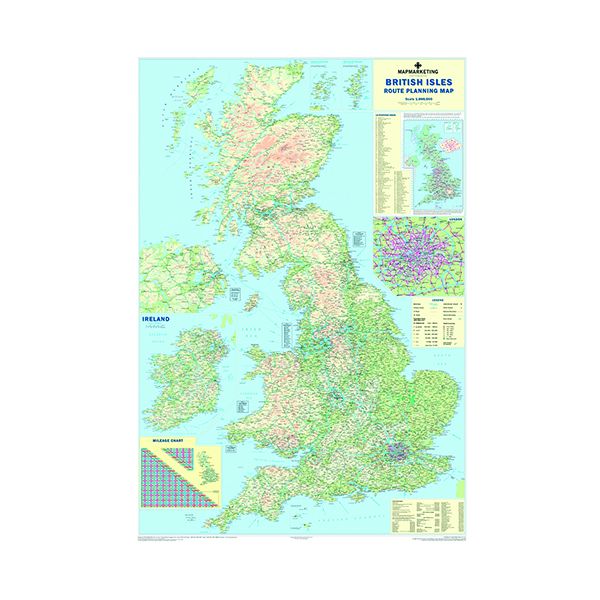
- Laminated map of UK and Republic of Ireland road network
- Shows motorways, A-roads, and B-roads within M25
- Inset with rail, ferry and airport phone numbers
- Mileage chart with distances between 66 major towns and cities
- Measures 1200x830mm, scale 1:800,000
- 2011 edition: includes 2009 administrative changes
This item has been discontinued.
VIEW REPLACEMENT